
The cooler temperatures beckon you to don your hiking footwear and explore areas in the Coachella Valley that you look at often from your car.
And with the Thanksgiving holiday approaching and trips to the mall for shopping in order, you'll need a way to recharge your batteries.
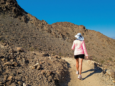
Lace up some sturdy shoes, slather on sunscreen, and hit the trails to walk off those overindulgences.
 MIRAGE TRAIL
(A.K.A. “BUMP AND GRIND”)
LENGTH: 2 miles
HIKING TIME: 1-2 hours
ELEVATION GAIN: 800 feet
DIFFICULTY: Easy/moderate
This is a “short ’n’ sweet” exercise hike above Rancho Mirage and Palm Desert, popular with locals because of its proximity and steep grade that affords a good workout. Dogs are not permitted on the Mike Schuler section of the trail that connects to the Bump and Grind, but are allowed on the section heading south (left at the trailhead) toward the Hopalong Cassidy Trail.
Hike right (northwest) at the trail sign indicating the Mike Schuler section. The trail climbs quickly and steeply, winding above the desert floor, with great views of the tree canopy surrounding the desert cities, as well as the urban environment of Palm Desert and Rancho Mirage beneath you. The trail continues up (and up!) until topping out, giving hikers a good view of the Santa Rosa Mountains to the south and the Little San Bernardino Mountains and Indio Hills to the north. This trail is heavily trekked by trail runners as well as hikers. Be prepared to encounter many people during your hike. If you turn left at the trailhead, you will eventually connect up to the Hopalong Cassidy Trail to the south in Palm Desert.
Directions: From Hwy. 111 in Palm Desert, turn right on Fred Waring Dr. if coming from Palm Springs, or turn left on Fred Waring if coming from Palm Desert/Indio. In about 100 yards, Fred Waring dead-ends at Painter’s Path. Turn left, drive for 100 yards, and park along the street where the trail begins just above and to the right.
Credit: Neil Gussardo
NORTH AND SOUTH LYKKEN TRAILS
LENGTH: 4.5/5/9 miles
HIKING TIME: 5 hours
ELEVATION GAIN: 900/800/1,700 feet
DIFFICULTY: Moderate
In 1972, the Skyline Trail was renamed the Lykken Trail in honor of Carl Lykken, a Palm Springs pioneer and the town’s first postmaster. The South Lykken Trail is 4.5 miles, the North Lykken Trail is a five-mile hike, and a shuttle of both is nine miles. This magnificent desert view trail travels along the San Jacinto Mountains above Palm Springs, roughly following Palm Canyon Dr. The views of Palm Springs and the valley, which stretch toward the eastern horizon, will be awesome as you negotiate through the rocky terrain.
En route to the end of the South Lykken Trail, you are treated to fabulous views of Palm Springs and of Tahquitz Canyon, held sacred by the Cahuilla Indians and abounding in vegetation and waterfalls.
Head west up the trail before the switchbacks begin; you will come to the trailhead sign. The trail climbs above Palm Springs, seen to the north and east as expansive city vistas for almost the next three miles before topping out above and near Tahquitz Canyon. It then makes a steep drop to the desert floor at the end of W. Mesquite Ave.
You can return to your car by retracing your route, or if you intend to do both the South and North Lykken trails, proceed as follows.
After dropping down to the trailhead at the end of W. Mesquite Ave., make your way east to S. Palm Canyon Dr. Turn north (left) and go several blocks to Ramon Rd. Turn left, and you will find the trailhead for the North Lykken Trail at the end of Ramon Rd. (If you are doing the North Lykken Trail by itself, this is where you will start.)
The trail will climb above Palm Springs and in about 1.5 miles reach the juncture with the Museum Trail, where you can rest at the picnic tables.
From there, the trail continues north above Palm Springs before dropping down into Chino Canyon. It’s a scramble down to the street, W. Cielo Dr., where you will have parked your car if doing the almost nine-mile shuttle hike. Or, if you are hiking the North Lykken Trail only, you can turn around at this point and return to Ramon Rd.
Directions: To begin hiking the South Lykken Trail, drive into Palm Springs via Hwy. 111, which becomes E. Palm Canyon Dr., and turn south onto S. Palm Canyon Dr. Proceed south to Canyon Heights Rd.; 250 feet farther along on the west side of the road is a trail sign. If hiking the North Lykken Trail, you will find the trailhead at the west end of Ramon Rd. If you want to do both the South and North Lykken trails as a shuttle hike, park another car at the end of W. Cielo Dr.
Adapted with permission from Philip Ferranti’s book, 140 Great Hikes in and Near Palm Springs (Big Earth Publishing). For more information, visit www.philipferranti.com
Hiking Safety Tips
• Carry at least 2 quarts of cool water for hikes up to six miles, and more water for longer distances
• Protect your head with a hat
• Use sunscreen
• Carry extra food, sunglasses, a windbreaker for the higher elevations, and basic first aid essentials such as aspirin, tweezers, Band-Aids, and moleskin
• Carry a comb in case you brush against a cholla cactus (guide the comb down through the thorns and flick off the entire ball of cactus)
• Carry a compass and a map of the area where you are hiking
• Hike with someone else
For other tips, call the Coachella Valley Hiking Club at 760-345-6234 or visit them online at www.cvhikingclub.net