
The opalescent light and serene, wine-dark water with its ever-changing shorelines are but a few hallmarks of the Salton Sea’s beauty. Yet the abandoned resorts and wrecked developments at the edge of California’s largest inland body of water are what often draw visitors, artists, and photographers.
Many of these visitors, however, overlook what lies below the surface of the myriad human endeavors that dot the sea’s beachfronts. Clues around the shore are many, and explorers can easily tease out this distinct landmark’s long and bewitching history.
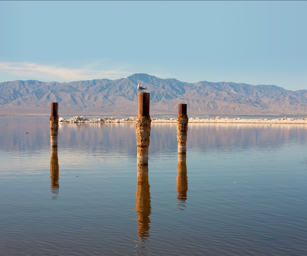
A seagull floats near the Sonny Bono Salton Sea National Wildlife Refuge, a major stop for birds on the Pacific Flyway. (Photo courtesy of thinkstockphotos.com).
How the Sea Came to Be
The latest incarnation of the sea was born just after the turn of the last century. Many people dreamed of the transformative possibilities of irrigation with water from the Colorado River, and it became a story of too much — and too little — water.
When Charles Robinson Rockwell planned to build canals to bring water to the Salton Sea area for agriculture before the turn of the 20th century, he got help from Canadian canal builder George Chaffey. Silt from the Colorado came along with the water and constantly had to be dredged out.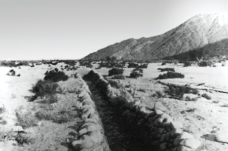
In February 1904, an exceptionally rainy period began, which caused the excess water to rampage down makeshift canals and pour unimpeded into the Salton sink for the next two years.
People generally think of the Salton Sea as a human mistake. Certainly human engineering participated in the flooding of the land; however, this had already happened many times in the centuries preceding, so a naturally occurring event just happened to coincide with the human attempt to use the water for economic development.
With no human intervention, chances are that the Colorado River would have created the lake anyway. The flood was finally stemmed and then dammed in February 1907 by Southern Pacific Railroad President Edward H. Harriman.
More than 1,668 miles of the canals — small, medium, and large — still exist today. Sometimes full of fish, the undulate beauty of these large aqua blue canals in cement skins snaking across the desiccated landscape is impressive. Traveling down Highway 111 is a great way to see the beautiful agricultural fields (500,000 acres under cultivation).
The Salton Sea’s shores, with fertile soil deposited by silt from the shifting Colorado River, make excellent farmland. Crisscrossing the land are small irrigation canals, to transport water for use in the fields.
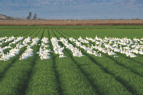
Snow geese rest in an agricultural field adjacent to the Salton Sea. (Photo courtesy of thinkstockphotos.com).
An Ancient Lake
The present Salton Sea is only the most recent of several historic lakes that periodically filled the Salton sink, or basin. The most noted was Lake Cahuilla. It was a great deal larger and dominated the Salton trough during the last part of the Pleistocene epoch nearly 40,000 years ago.
While the present Salton Sea measures 34 miles long, 16 miles wide, and 226 feet below sea level, Lake Cahuilla at its high point was 110 miles long, 31 miles wide, and about 39 feet above sea level. The actual shoreline of Lake Cahuilla varied as the water fell and was replenished seasonally by the Colorado.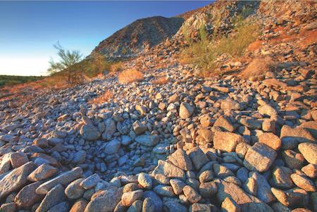
It is easy to spot the “bathtub rings” left behind by the lake at some of its high points both prior to A.D. 1000 and after A.D. 1500. (One of the best places to see this is the Santa Rosa Mountains on the west side of the Salton Sea from Route 86.)
The darker, lower sections of the now dry lake bed were underwater. The whiter encrustations on rocks and ancient beaches are called travertine or tufa, a freshwater lime deposit. The ancient shoreline is visible on Travertine Rock (an islet of bedrock projecting above the old high water mark) off Highway 86, near Desert Shores on the northwest shore of the present sea. Wave erosion is viewed along the northeastern shore, south of Mecca.
There are also beaches of large, wave-polished rock. Miles of Pleistocene gastropods and mollusks were stranded as the water retreated, leaving long windrows that stretch for miles along the ancient beaches of the northwest and eastern margins of the Salton Sea.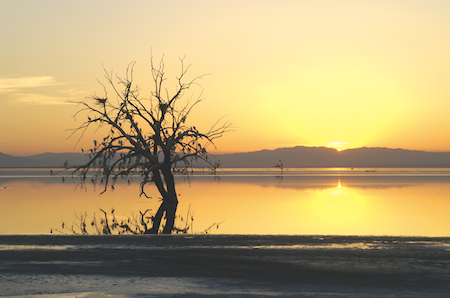
The ancient lake contained rich food resources, and members of the three tribes that lived nearby left artifacts and rock circles that indicate camps, both temporary and permanent, in the area. Bones and shells in ancient campfires reveal bonytail and razorback sucker fish, freshwater mussels, and water birds, particularly American coot.
Ancient foot trails are also easy to spot. A historic marker on old Highway 78 interprets the history of Indian migrations from the Colorado to the Salton sink and beyond. When the light is low at sunset in this northeastern location, the subtle linear depression of a trail is visible across lava rock and along a wash.
Other indications of human habitation include sleeping circles in the Fish Creek Mountains. Standing on an ancient footpath near these sites fills a visitor with enormous respect for these ancient people who lived at a time when the lake made life bountiful in this arid land.
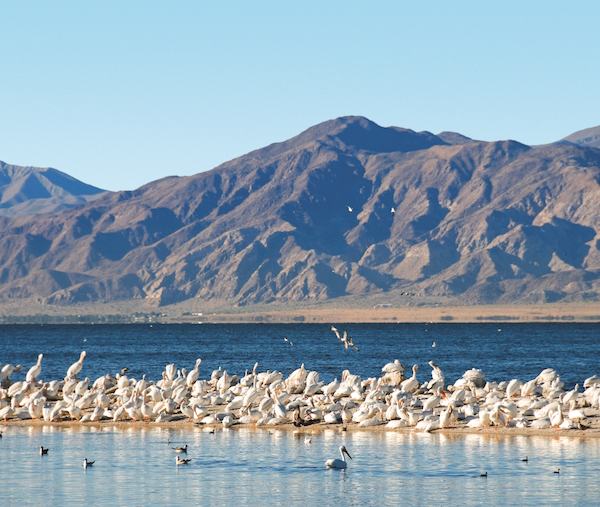
More than 400 species of birds use this important migratory stop over. (Photo courtesy of thinkstockphotos.com).
Natural Wonders Await
Visitors will be overwhelmed by the bird life at the Salton Sea shore. In late spring, great egrets — majestic white birds with vast wingspans — nest high in the trees along Highway 111 toward Indio. They fold and unfold their wings, launching from their rough stick nests in treetops and gliding among upper branches on the afternoon winds that blow steadily off the Salton Sea. Pelicans flit along the lakeshore, which serves as one of the stopping grounds for migrating birds along the Pacific Flyway, as they have done for thousands of years.
Today, dead trees snag in the shallow water and on drying mudflat playas in several places, including Red Hill on the east side of the lake. The skeletal branches — a strange, evanescent sight — contain the stick nests of double-breasted cormorants and smaller egret varieties and herons.
Hidden active geological structures, which create earthquakes and cracks in the earth, vent magma and heated steam under the lake and playas. Now, more than 80 thermal plants capture this energy to generate electricity. At night, the plants glimmer on the horizon, small cities of light, releasing large clouds of vapor and steam. In the daytime, the dull rumble of working turbines travels across the flat playas. While the clouds of vapor may have unanswered environmental issues that are being discussed, these plants are spectacular sights.
Many contributing factors leave the future of the Salton Sea uncertain, but this enigmatic saltwater lake in the California desert beckons those who wish to explore its compelling beauty.